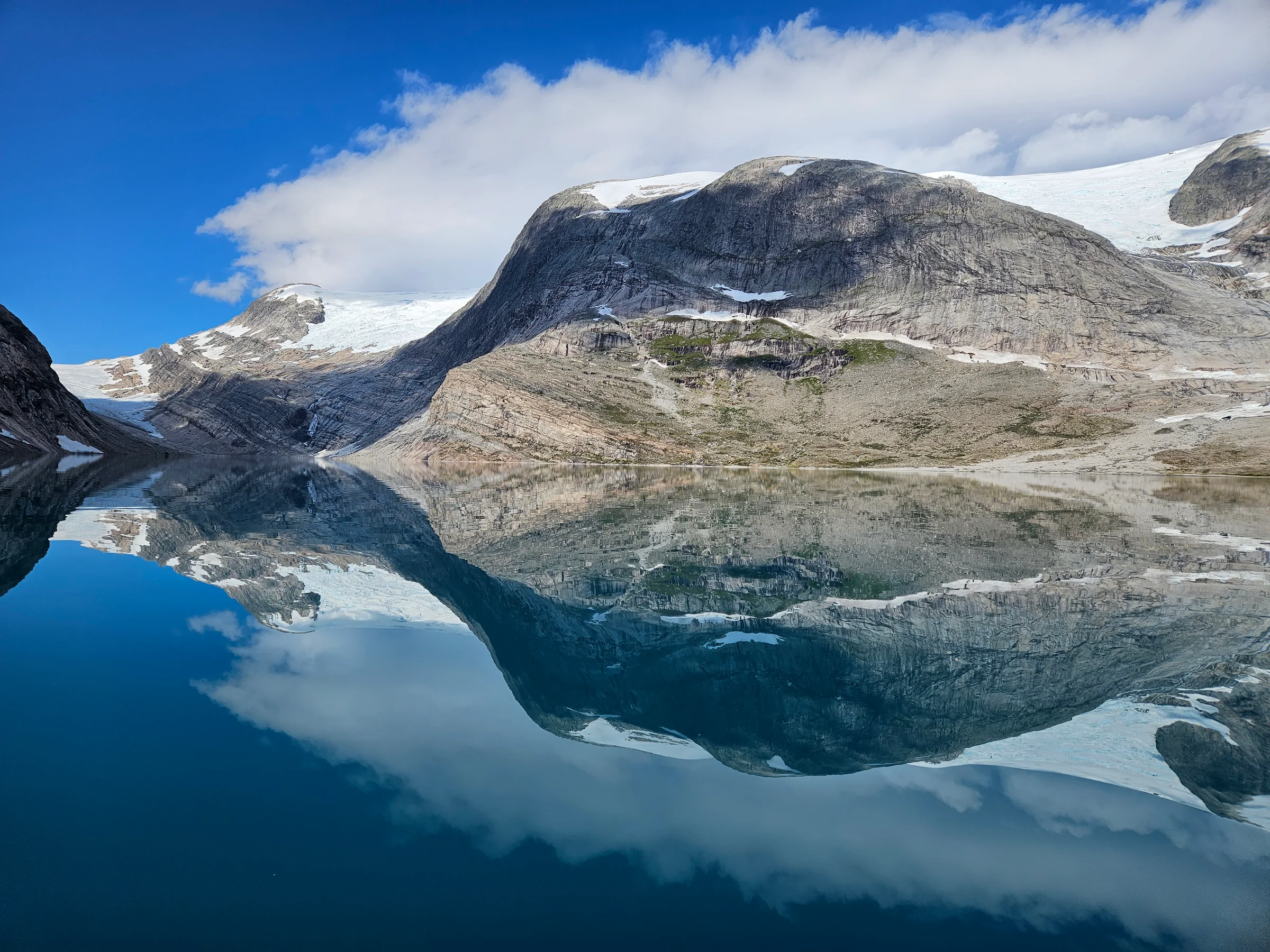
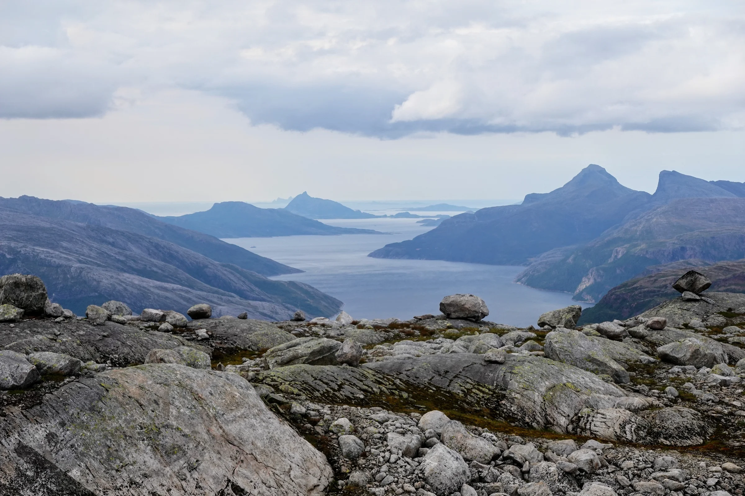
This was my second expedition after Patagonia. Like the first, it started with months over maps and aerial images: trying to read terrain from satellite photos, guessing at which sections of river might be navigable, judging whether valley sides would be stable or steep scree. I had settled on an isolated valley in Saltfjellet-Svartisen national park, in Nordland, a route that crosses the Arctic Circle heading south. When an eight-day window of good weather was forecast, I jumped on a train. Three days later (I had flown Amsterdam to Oslo, then taken trains and buses north) I was standing at the edge of Storglomvatnet with a hundred-litre pack.
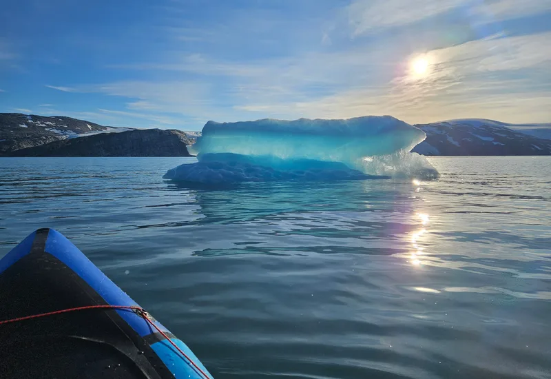
Large lakes are treacherous for packrafts. Wind and the waves it generates can make progress impossible and cause capsize; in water this cold, a drysuit only slows the hypothermia. The wind was against me that first morning, but barely. I crossed confidently.
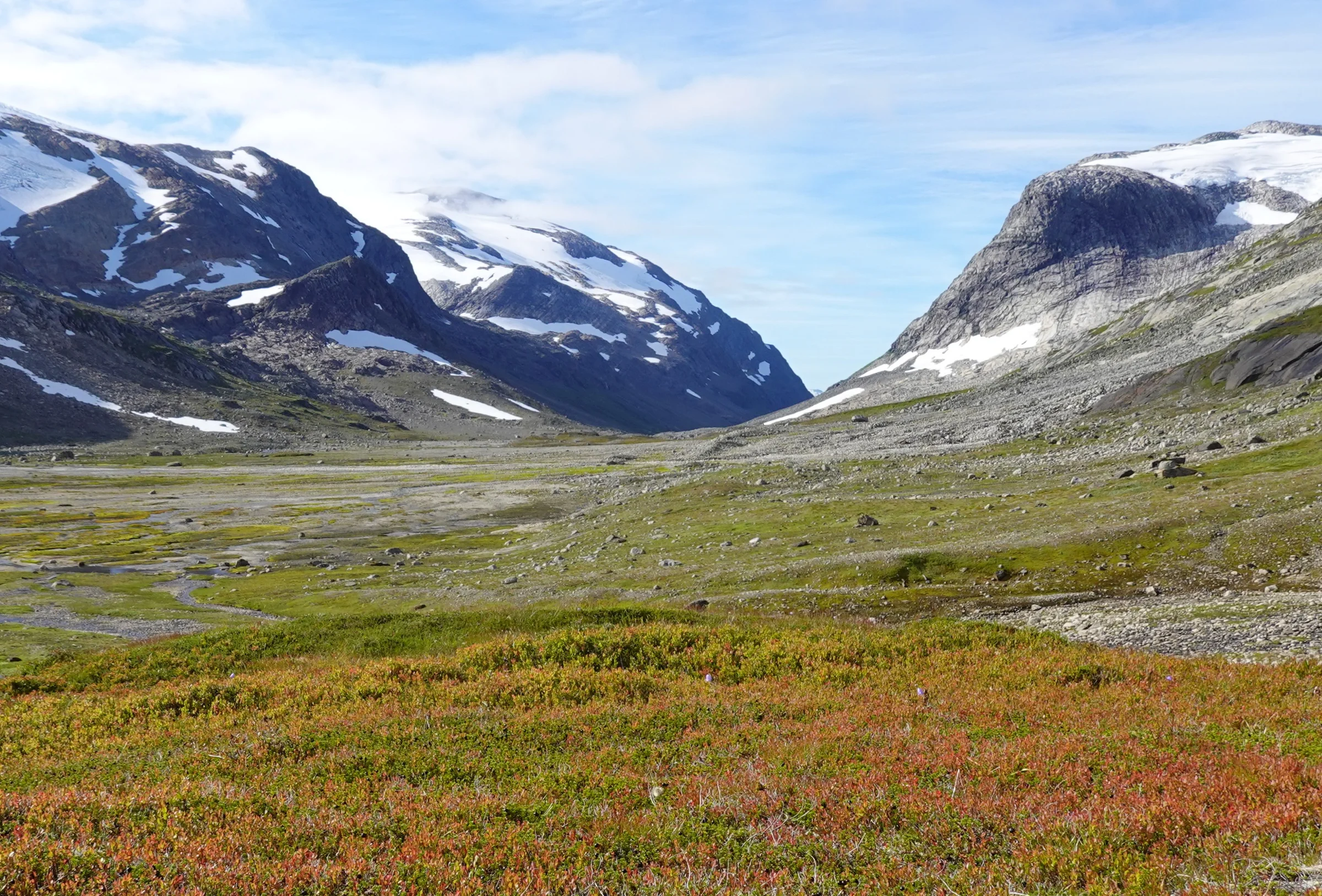
Into the valley
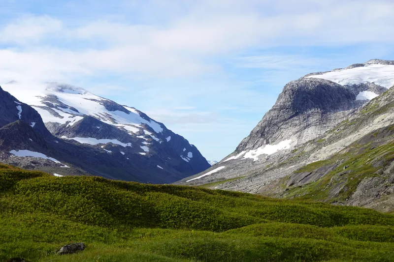
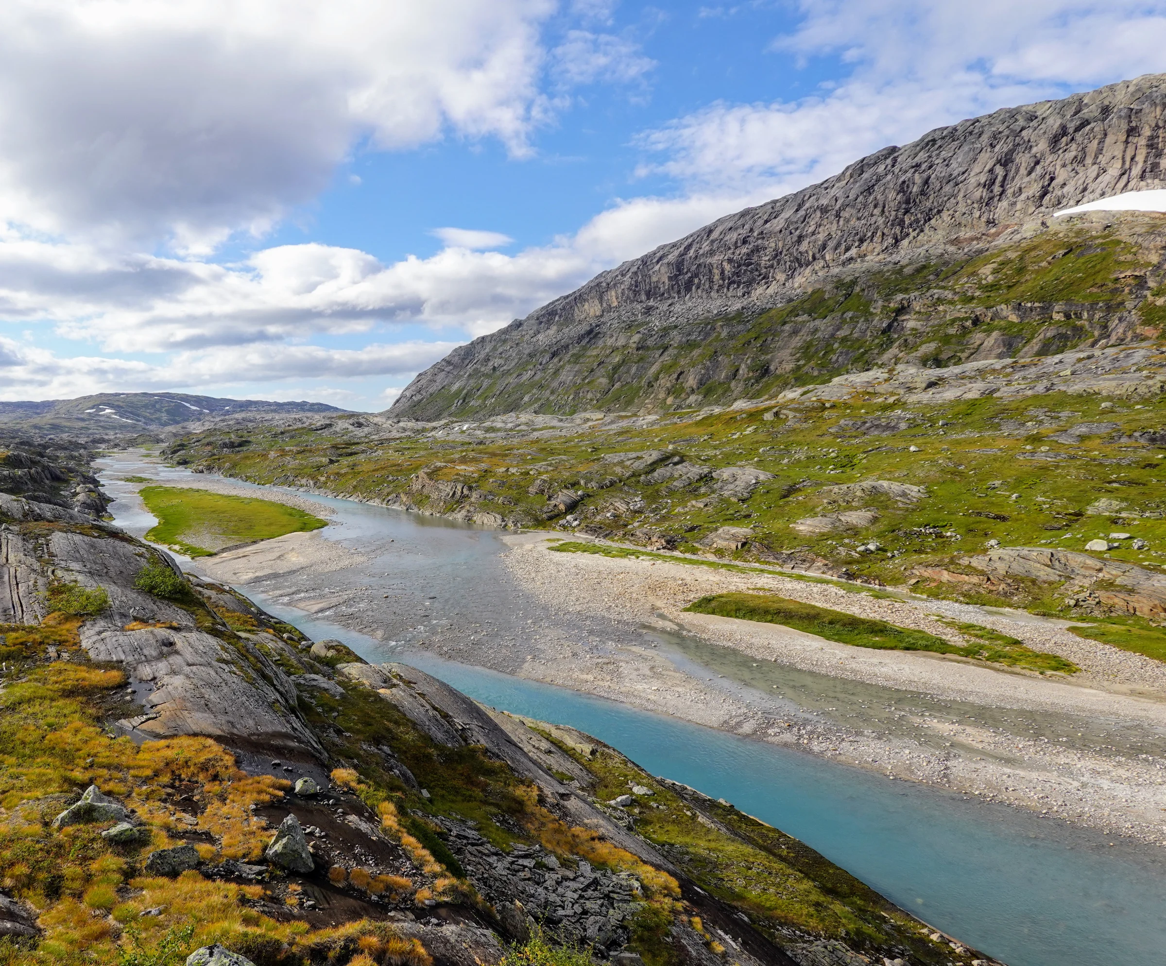
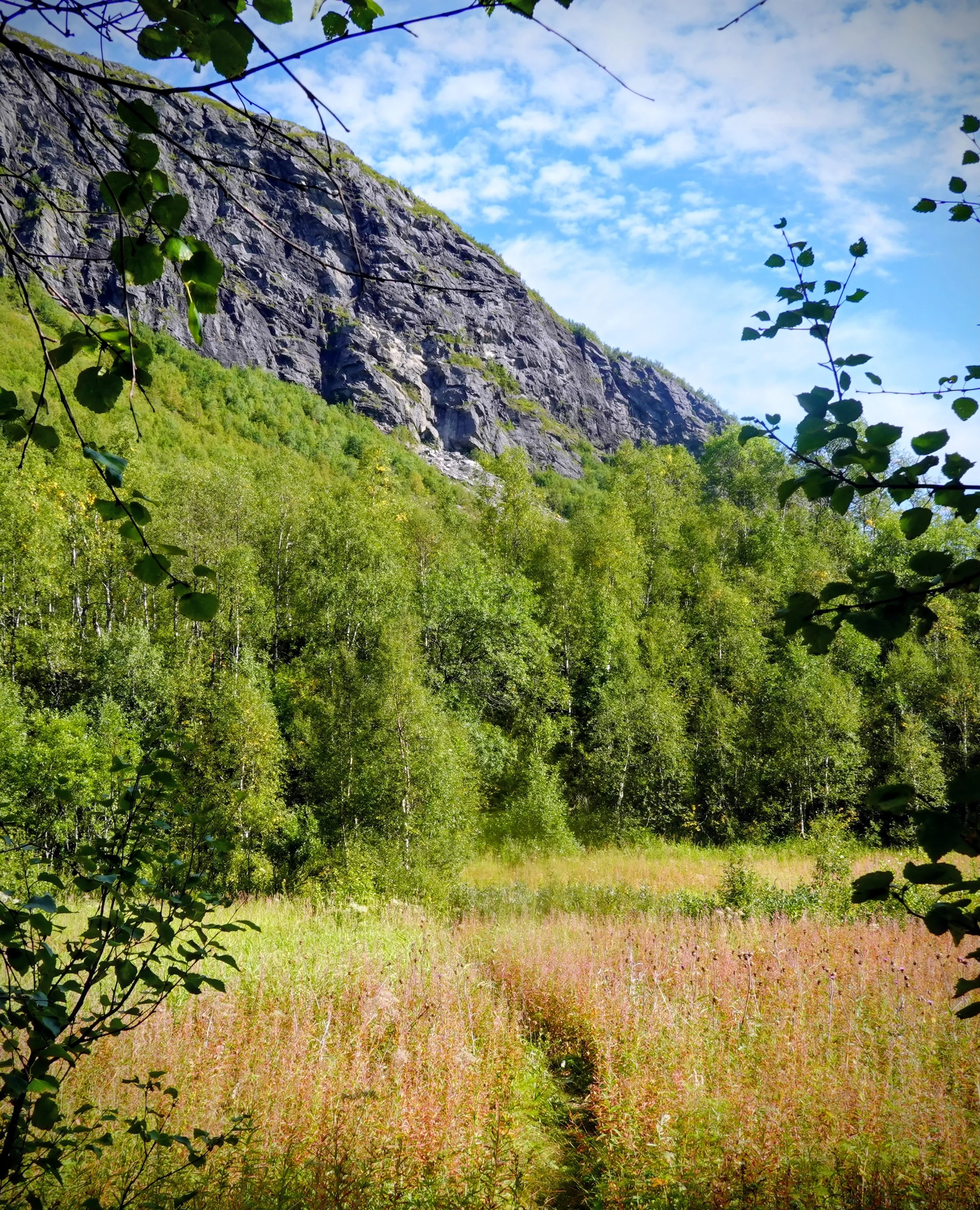
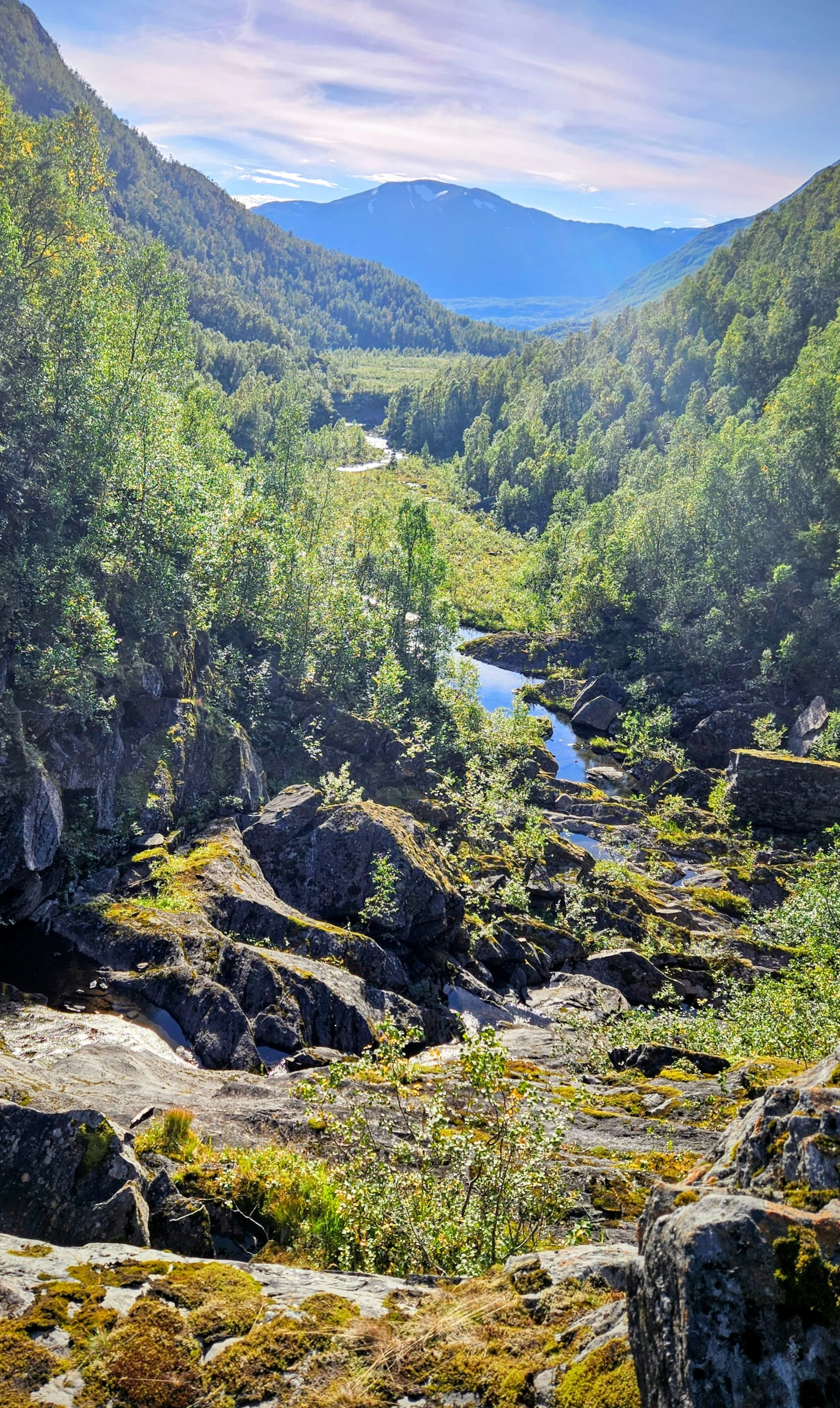
Beyond the lake I entered the valley I had been studying for months. The terrain was easier than I had feared, and magnificent. My 100-litre pack was larger than my torso. At each rest stop I took in the landscape and absorbed the solitude. I was simultaneously amazed, joyful, and focused.
The rapids

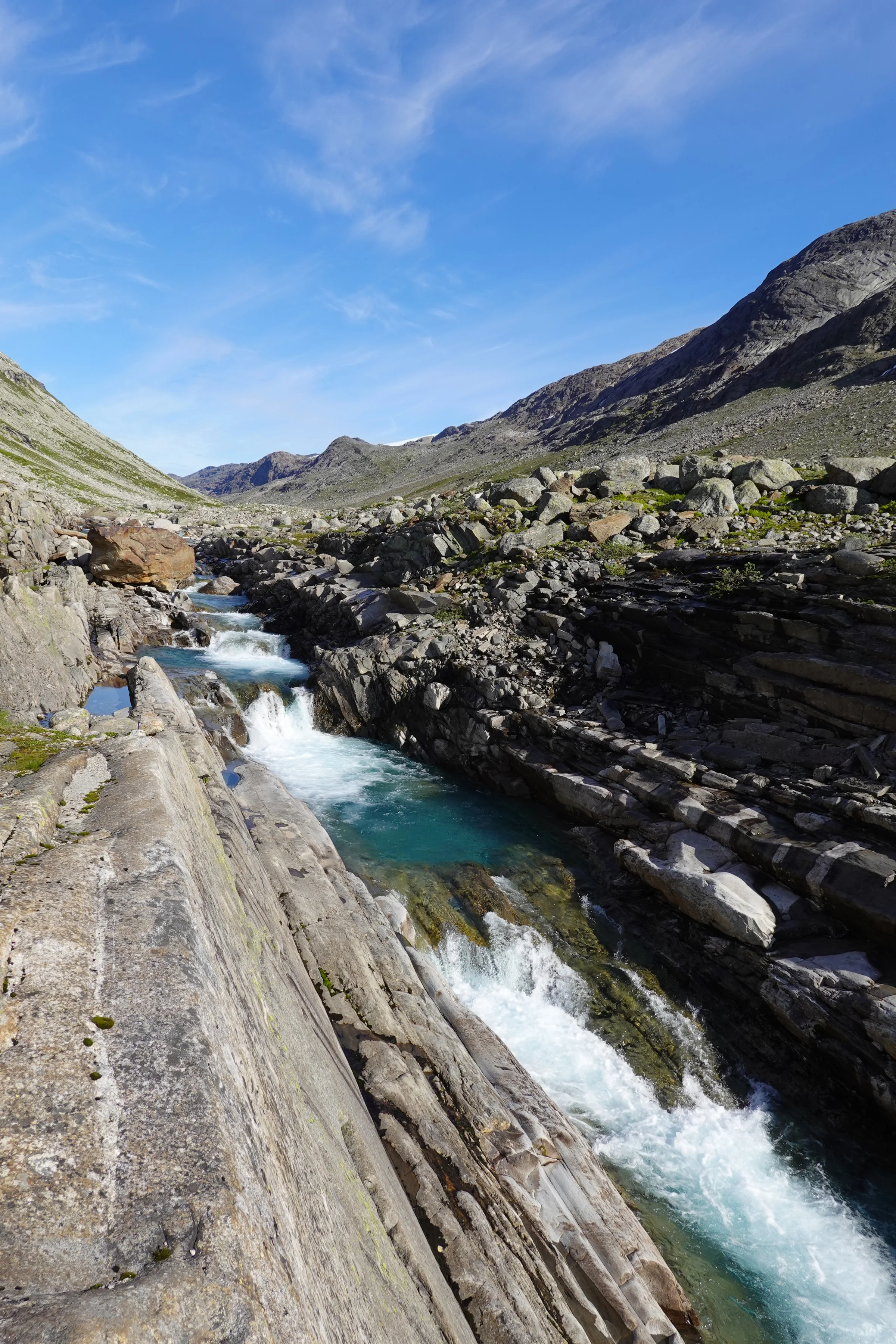
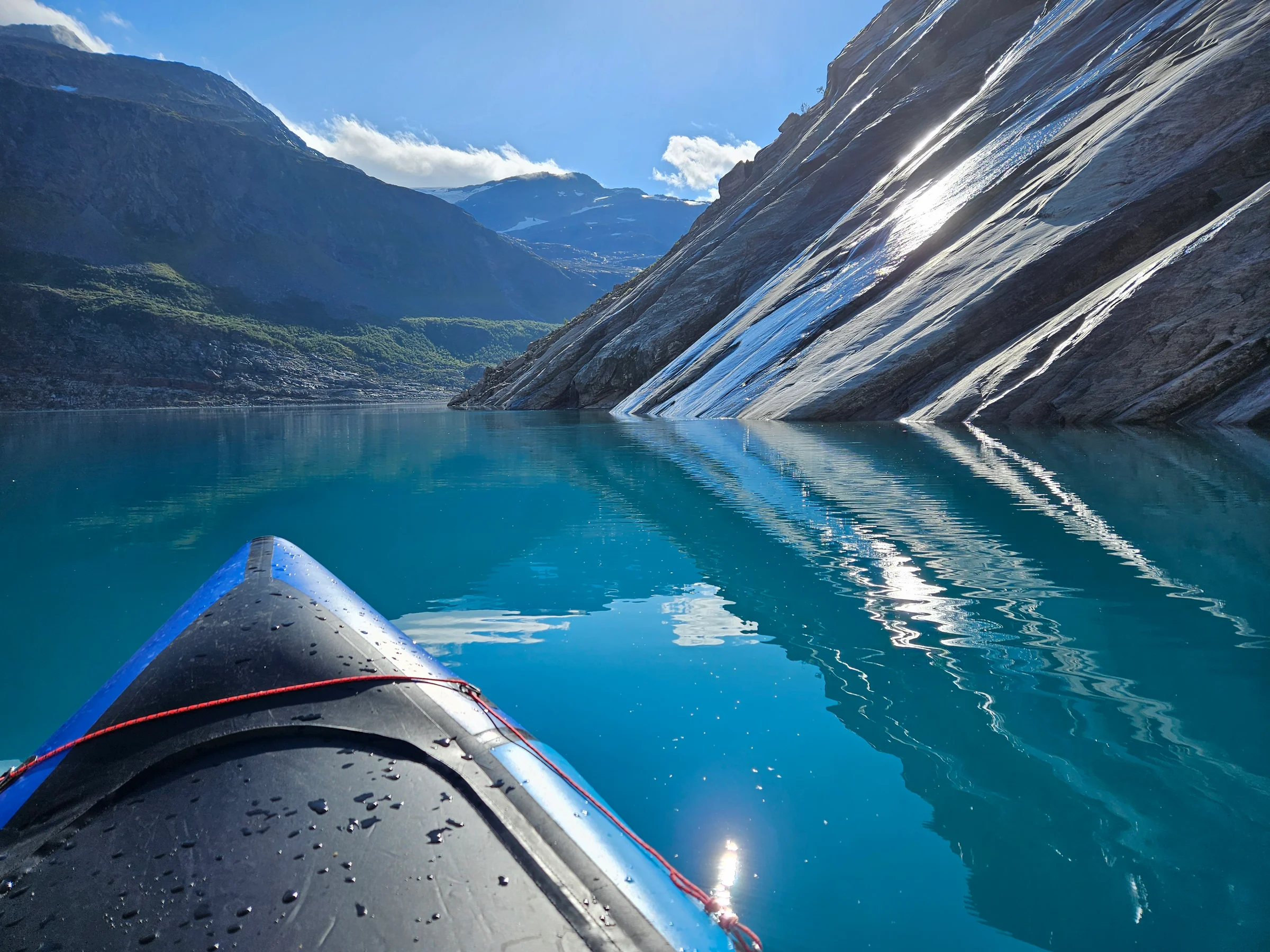
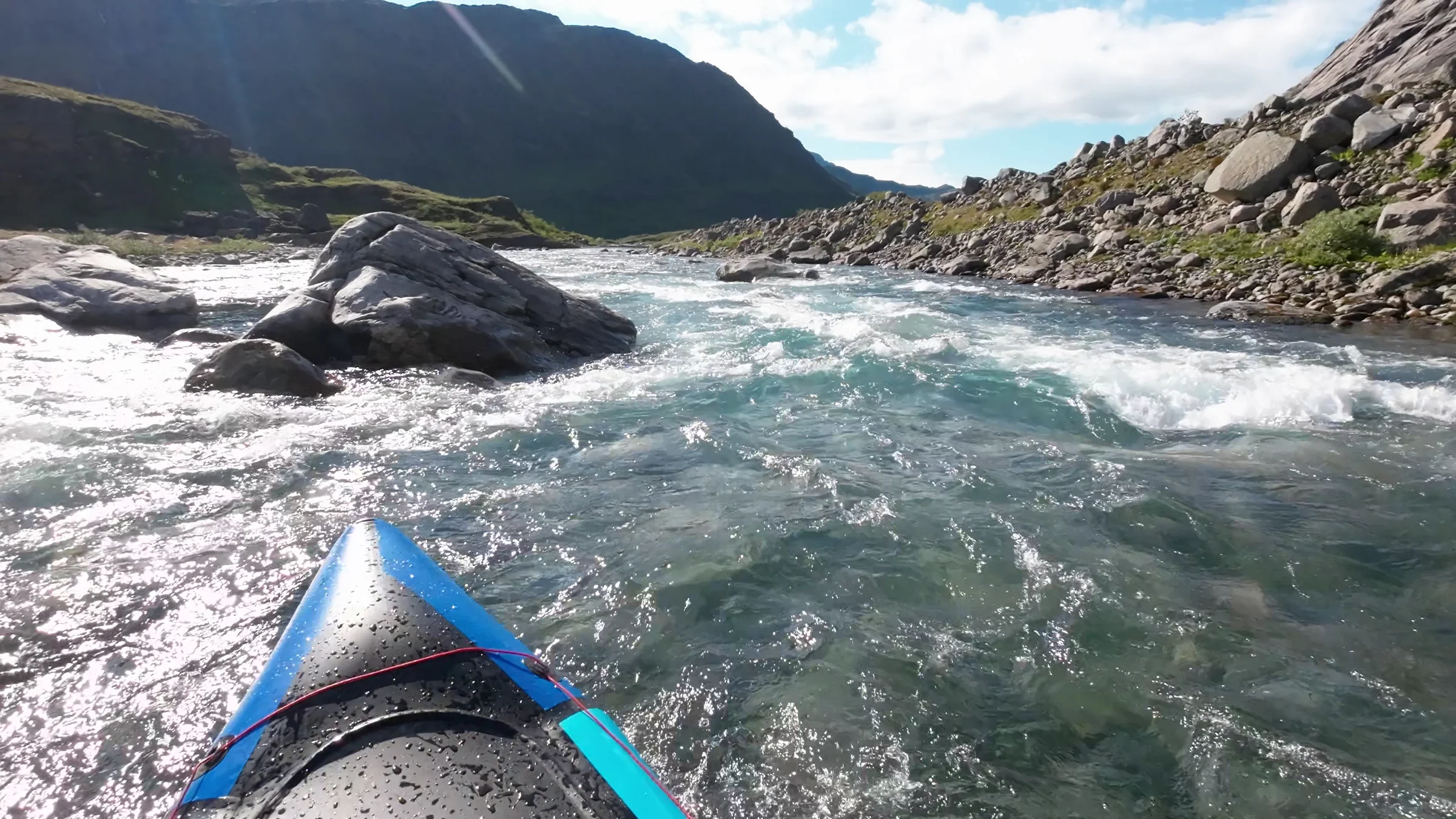
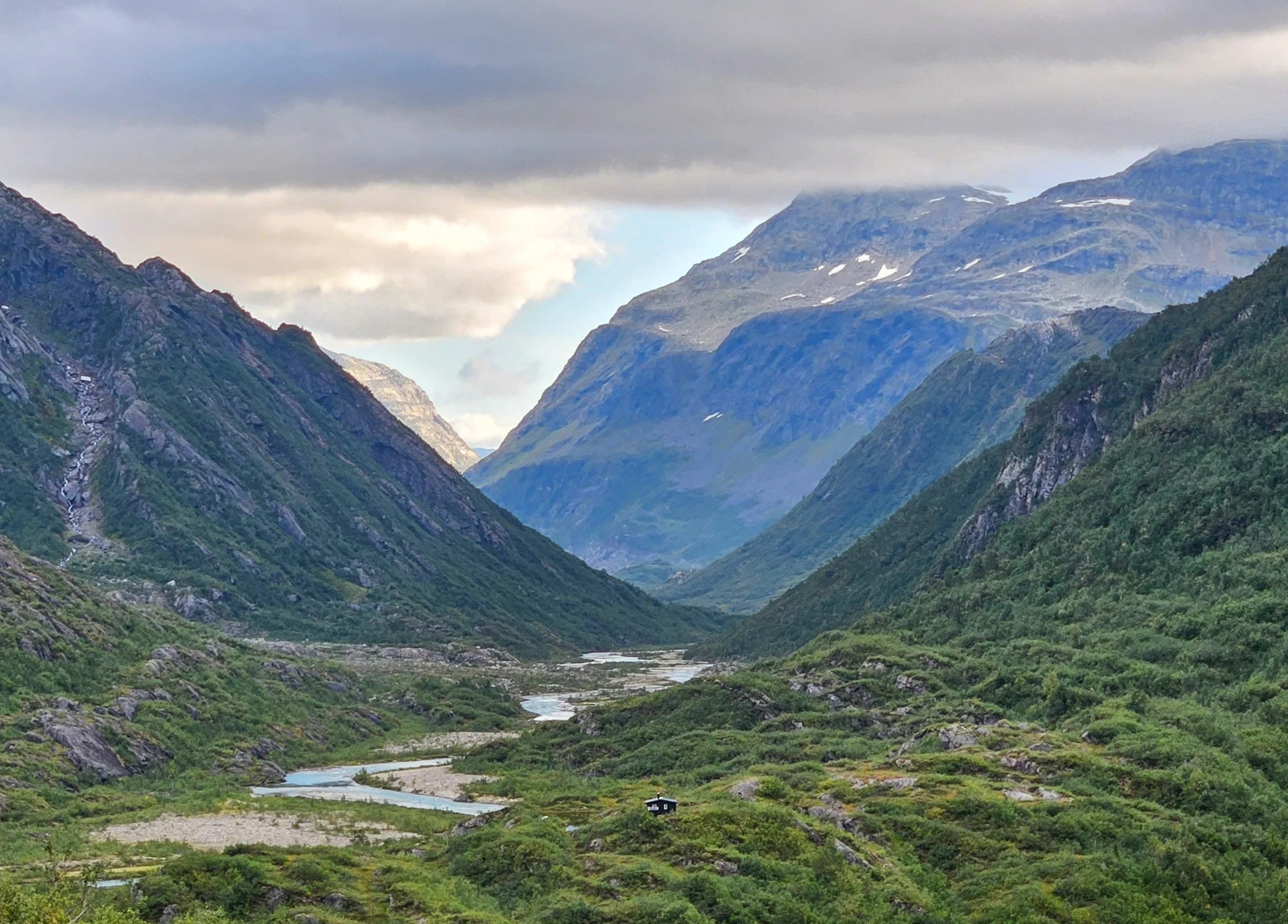
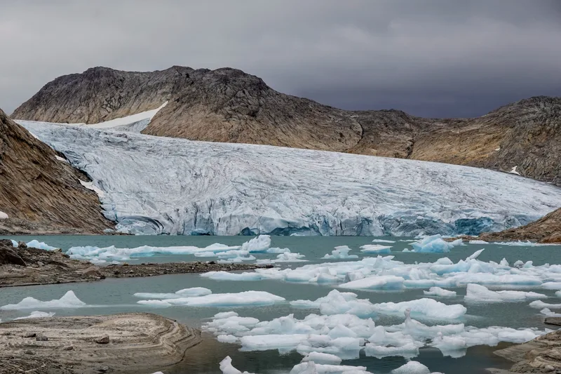
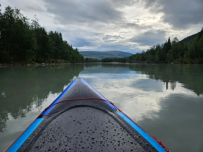
On the third day I glided across an intensely blue glacial lake, smooth as a mirror, and then entered the Glomåga, moving fast and effortlessly. On water I am free from the weight of the pack. The rapids are so much fun, I laugh alone, I feel silly… but there’s no one to judge me (until this article). Then, about ten kilometres in, I heard something deeper ahead. I got to the bank before the current could accelerate, climbed a mossy boulder to see what was coming, and saw the whole Glomåga narrowing to under two metres, churning and swirling between enormous blocks. This was well below my abilities. Going solo down this would have been madness. I deflated the raft and walked.

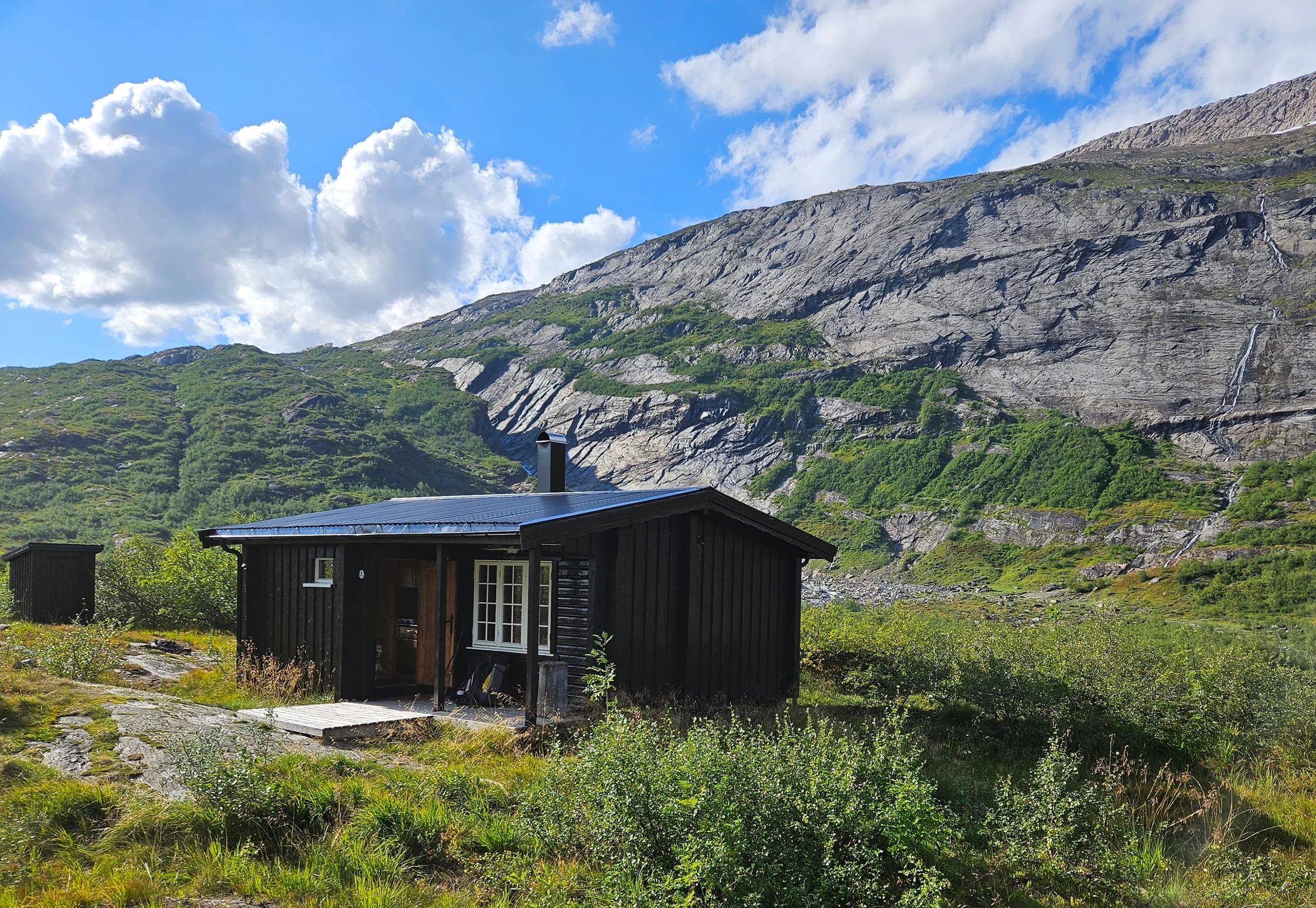
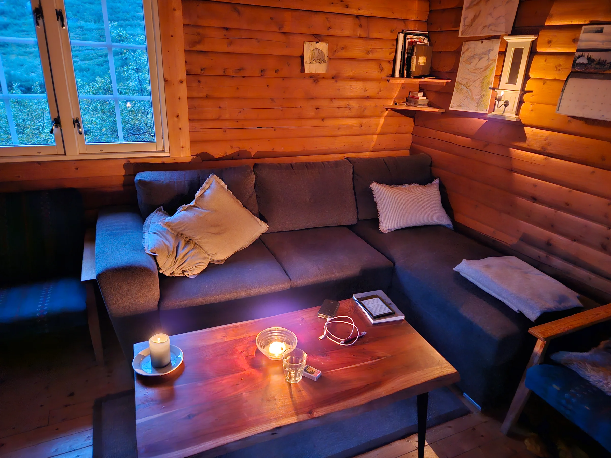
A few dozen metres further, I stumbled into a hut. Unmarked on the maps I had consulted: a state-owned cabin, free, unlocked, immaculate. The guestbook dated to the hut’s opening in 1991; perhaps thirty visitors a year. One entry recorded the first descent of those rapids, in 2010, by professional kayakers on a Red Bull expedition. Their message noted they would run the rapid I had just portaged, and the ones beyond. Each to their own capabilities.
The fjord
I was ahead of schedule in time and food. In the hut’s sofa I hesitated for a long time: take the short way out before the weather turned? Or use this opportunity to reach the Nordfjord, a place I had dreamed over on the map during planning, then ruled out as too ambitious? The deciding factor: by leaving the raft and four days of food at the hut, I could shed over 10kg. I sent a message to my safety contact via satellite messenger: “Rapides super sympas auj. J’ai trouvé une cabane tout confort, alors j’y reste pour la nuit. Demain je vais voir le Nordfjord.” And I went to sleep.
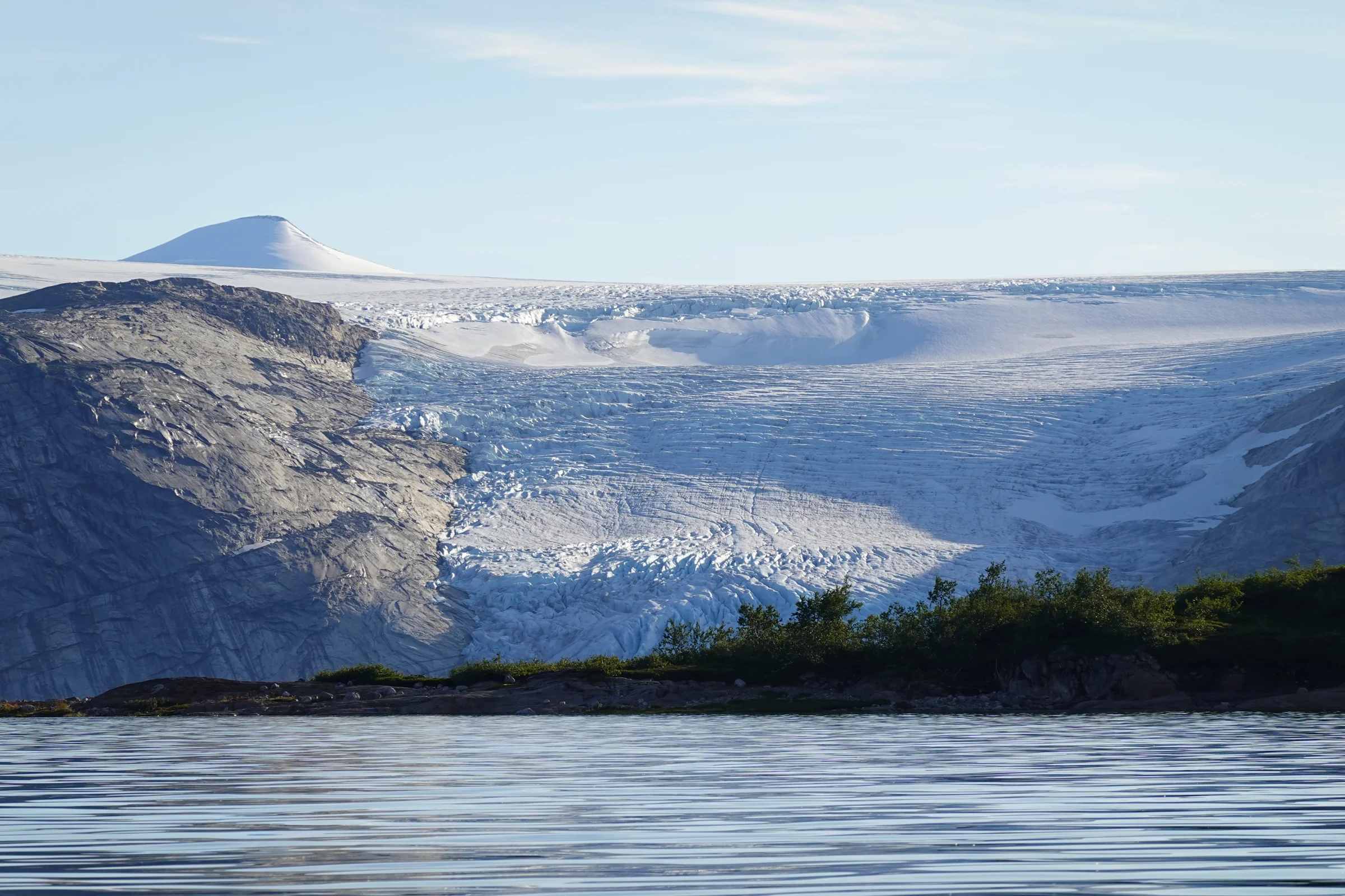
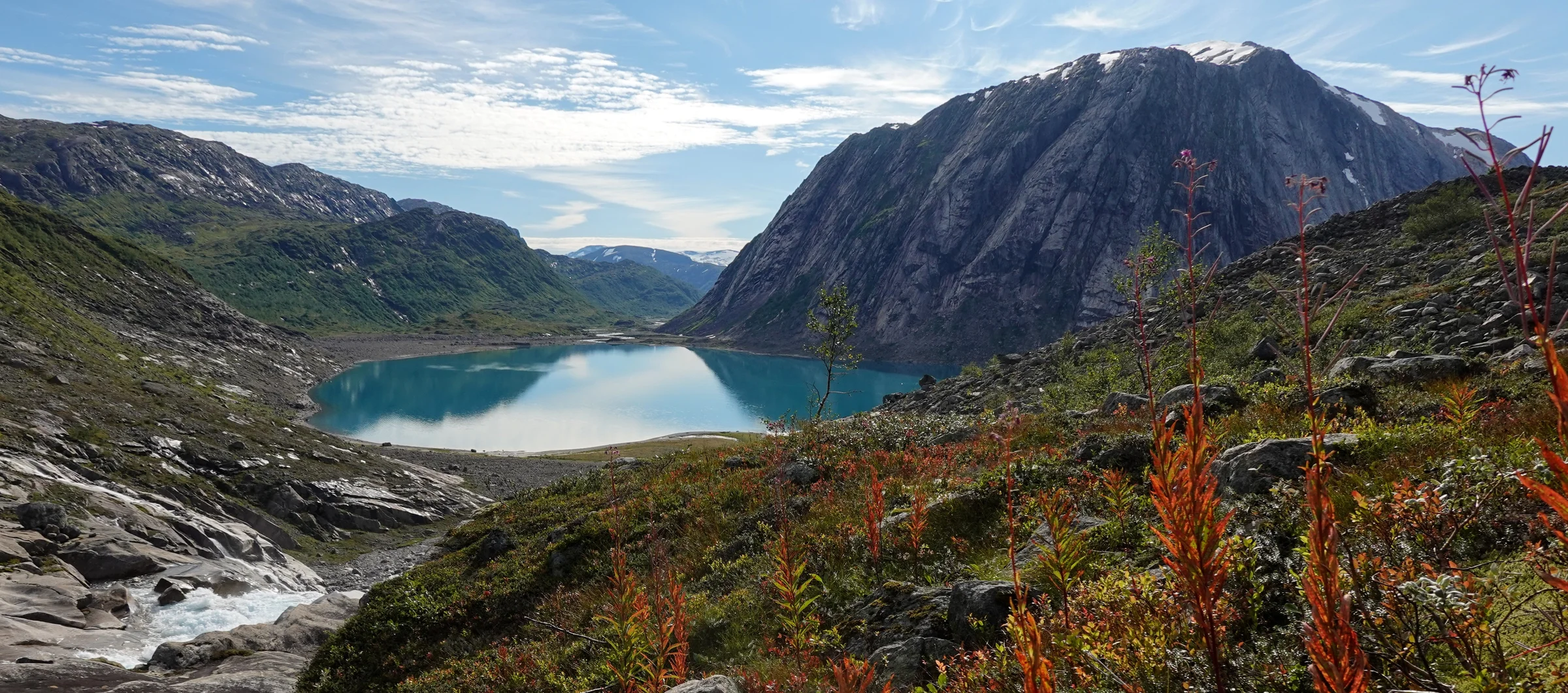
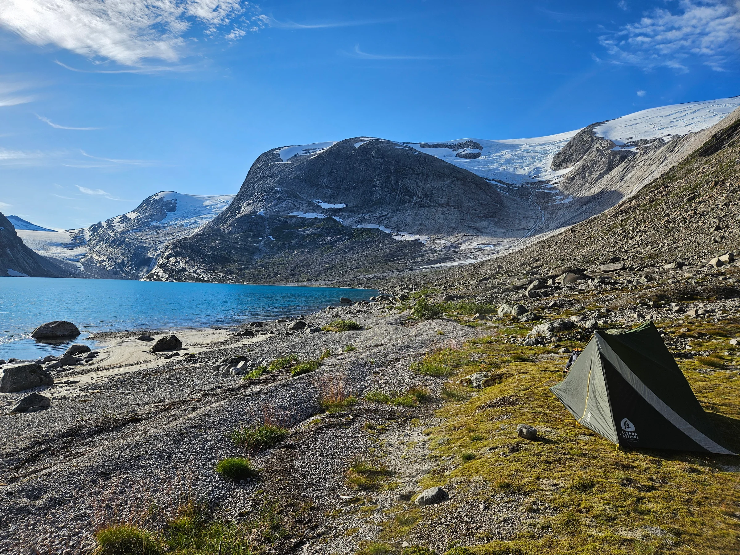
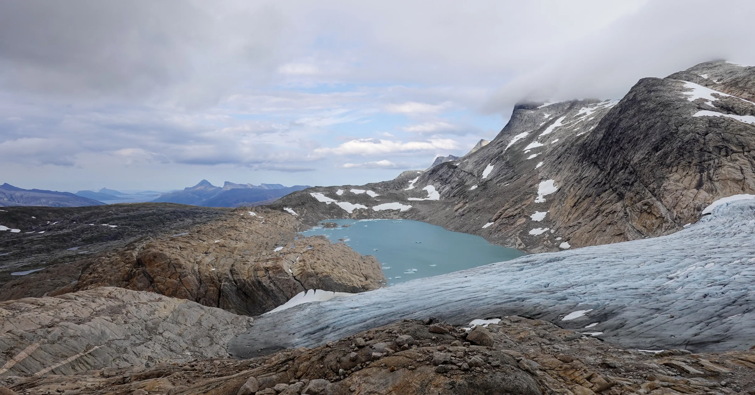
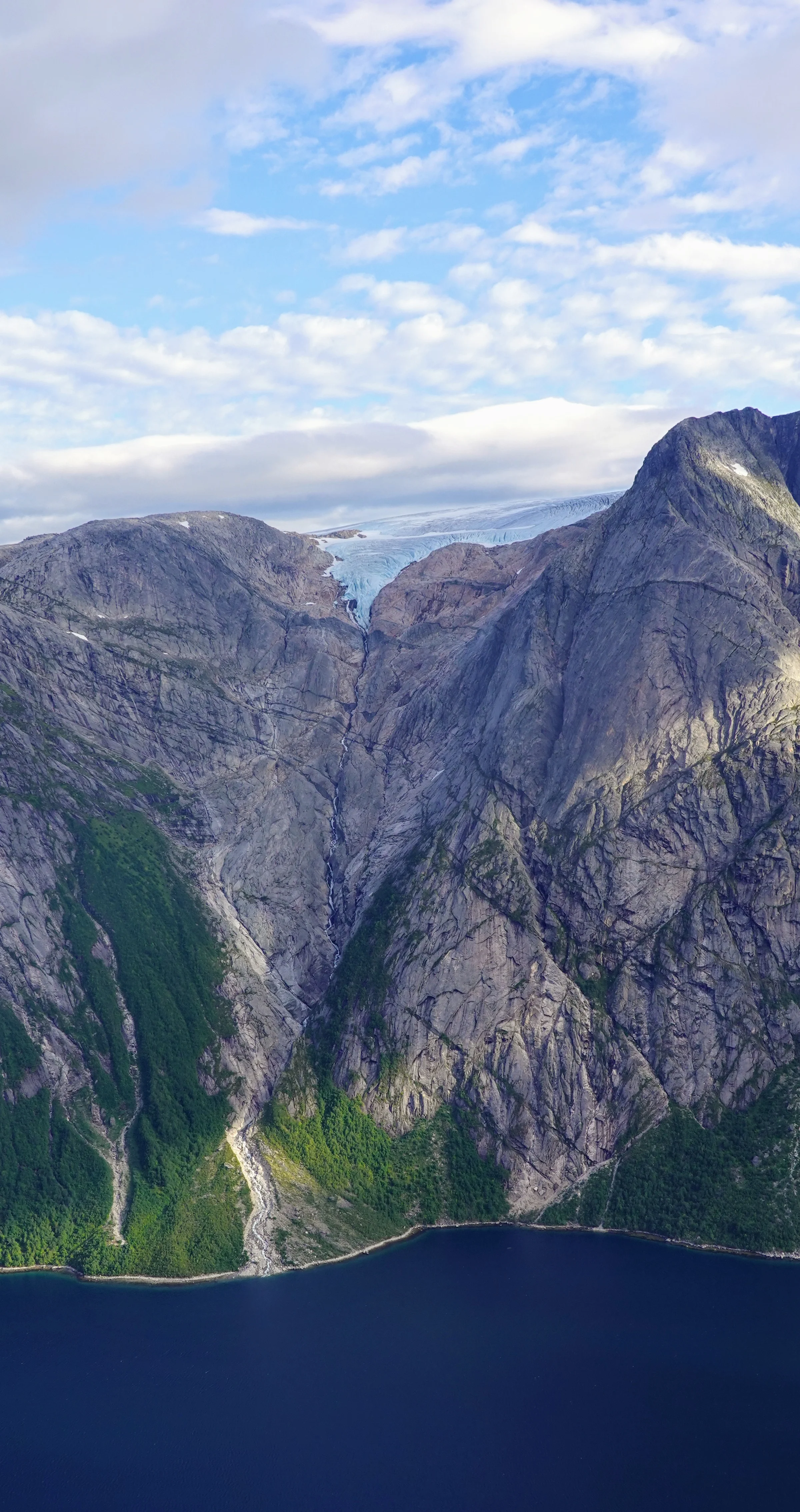
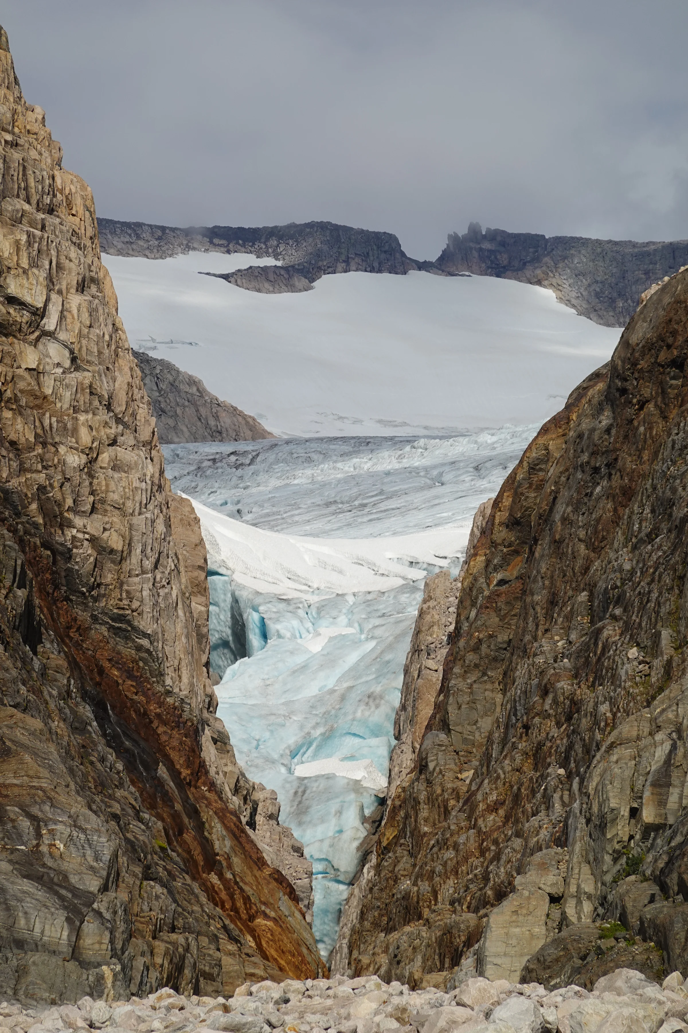
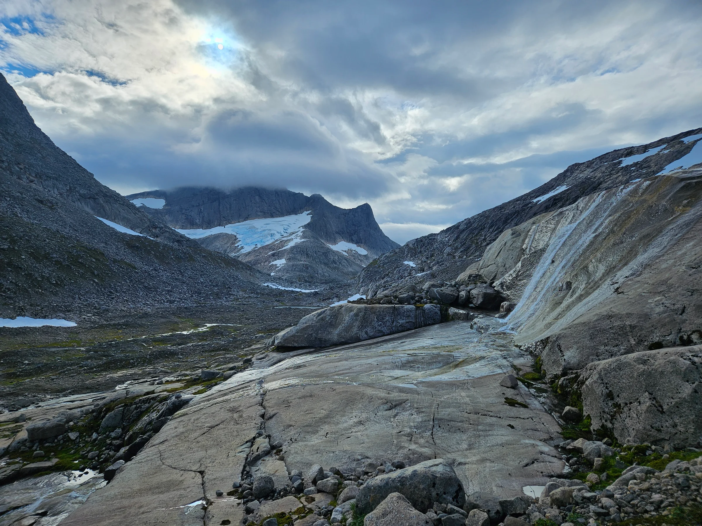
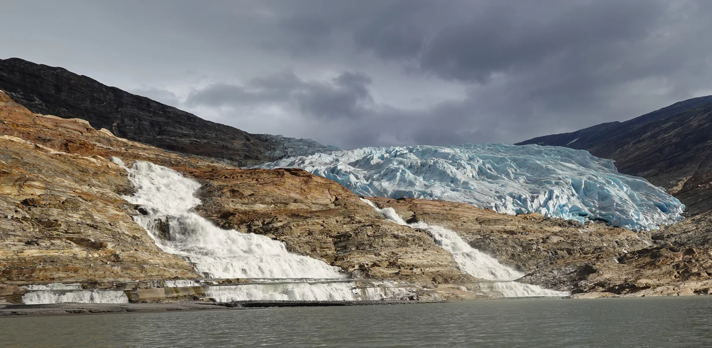
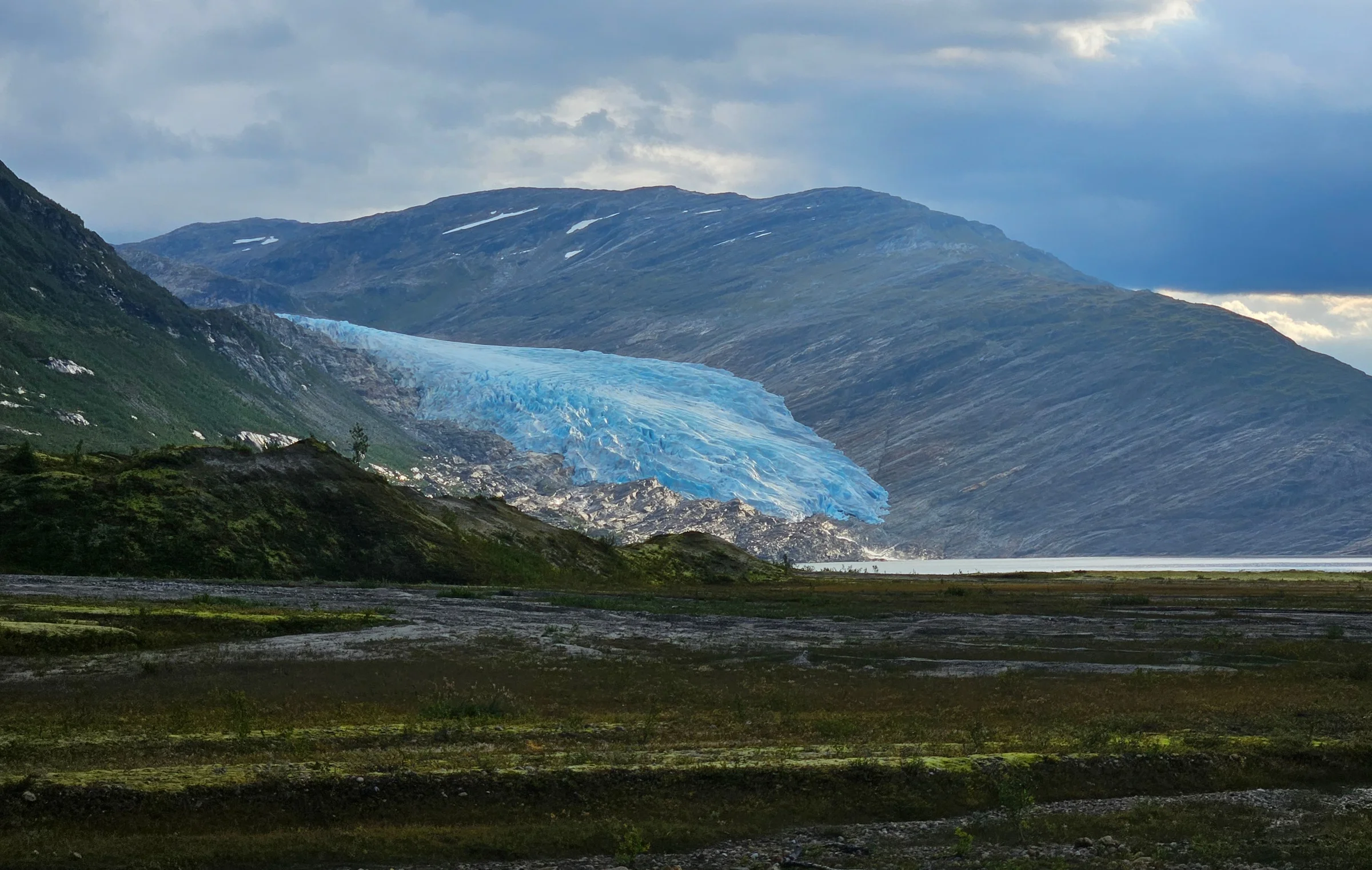
I left at dawn. After a marshy stretch, I followed the stony bed of a stream uphill to avoid the scrub, waded a large river knee-deep, and climbed progressively on glacier-polished rock. Then: a bare glacier, no snow cover, which meant no risk of falling through a hidden snow bridge. The few crevasses were narrow enough to step over, the slope was gentle, and I had microspikes and an ice axe. Yet stepping onto the ice, I had the clear feeling I was doing something stupid. It was my first time crossing a glacier alone, and I would have liked real crampons. The anxiety seemed irrational, but I listened to it anyway, and made a promise to myself, the way others might say a prayer: “I will turn around if I hit anything I can’t safely manage”.

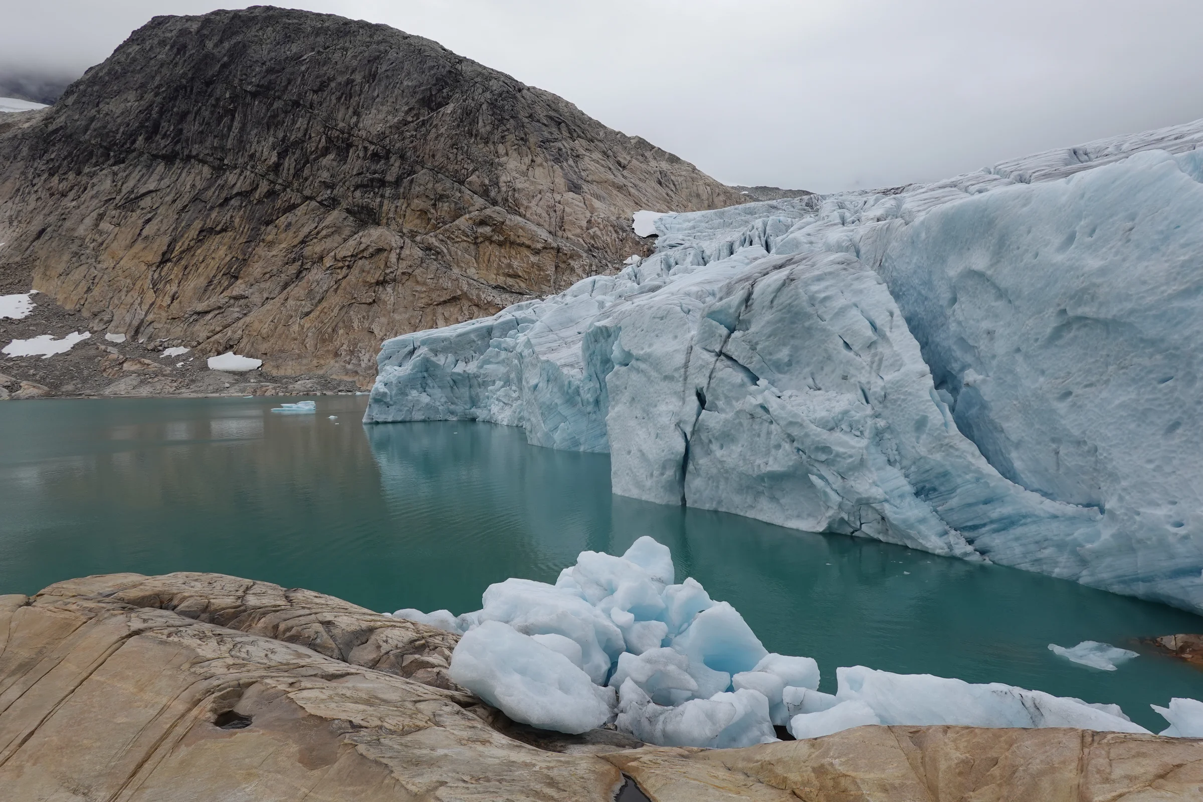
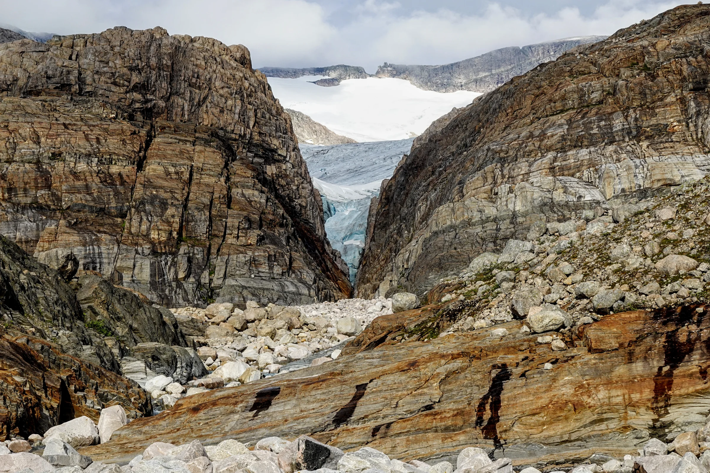
The glacier itself went smoothly. The exit did not. The glacier had retreated further than the satellite images had shown, and at the far edge a rimaye (the crevasse that forms where ice meets rock) just over a metre wide separated the glacier from the rocky promontory on the other side. The rock was slightly higher. Ten or fifteen metres below, I could hear a meltwater torrent. Jump? With microspikes I hadn’t slipped so far, but I didn’t trust them for a jump onto a higher surface. In a few seconds I decided: unacceptable risk. I’d take the long detour. Except… a little higher, there was a passage. A step cut with the ice axe, one move of downclimbing, then through a chaos of ice blocks. It was safe enough. I still let out a long sigh on solid rock.
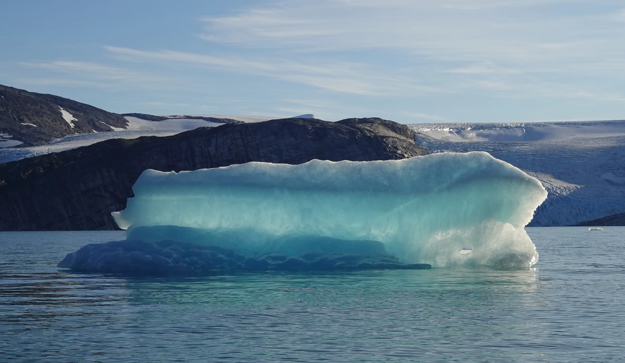
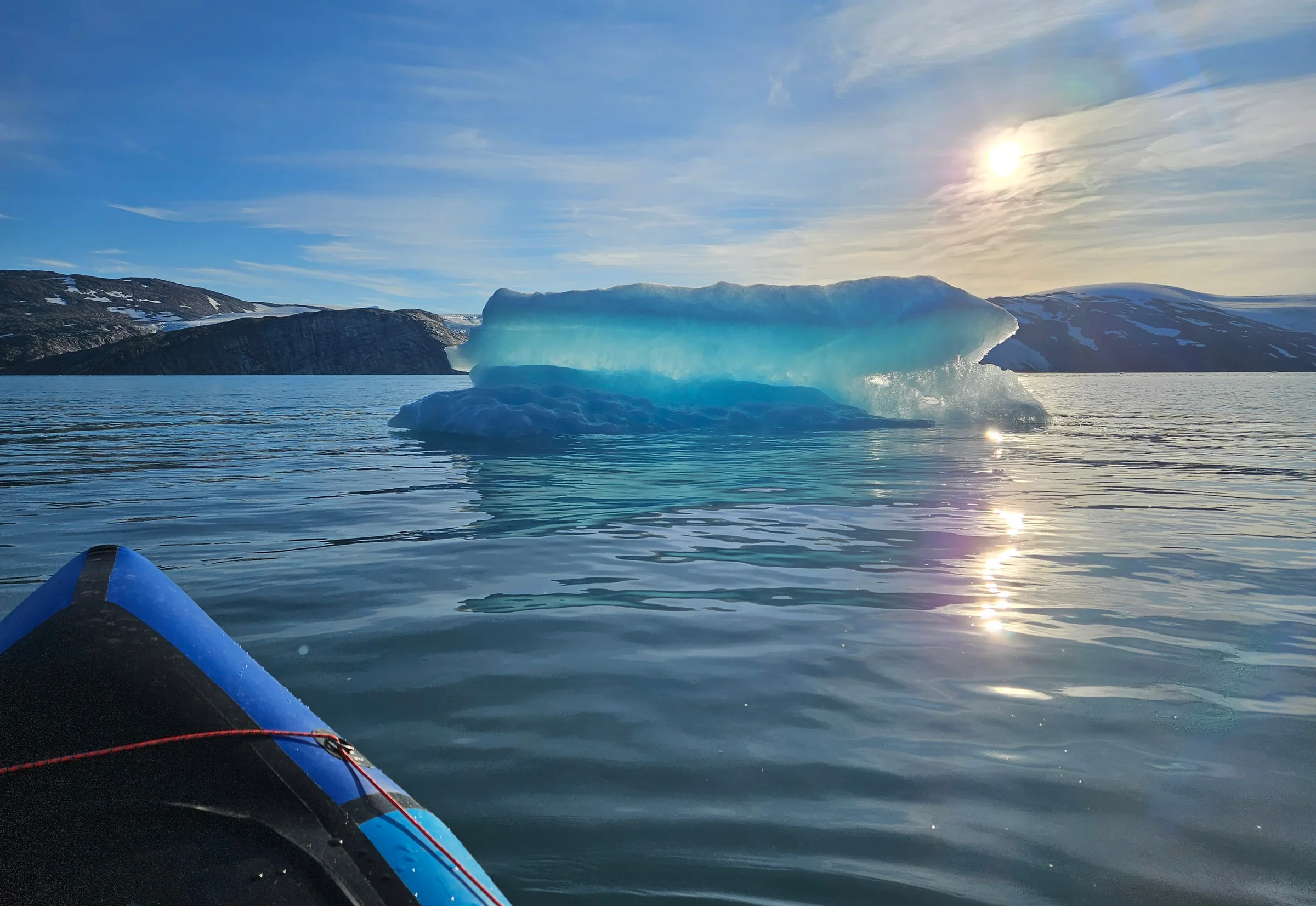
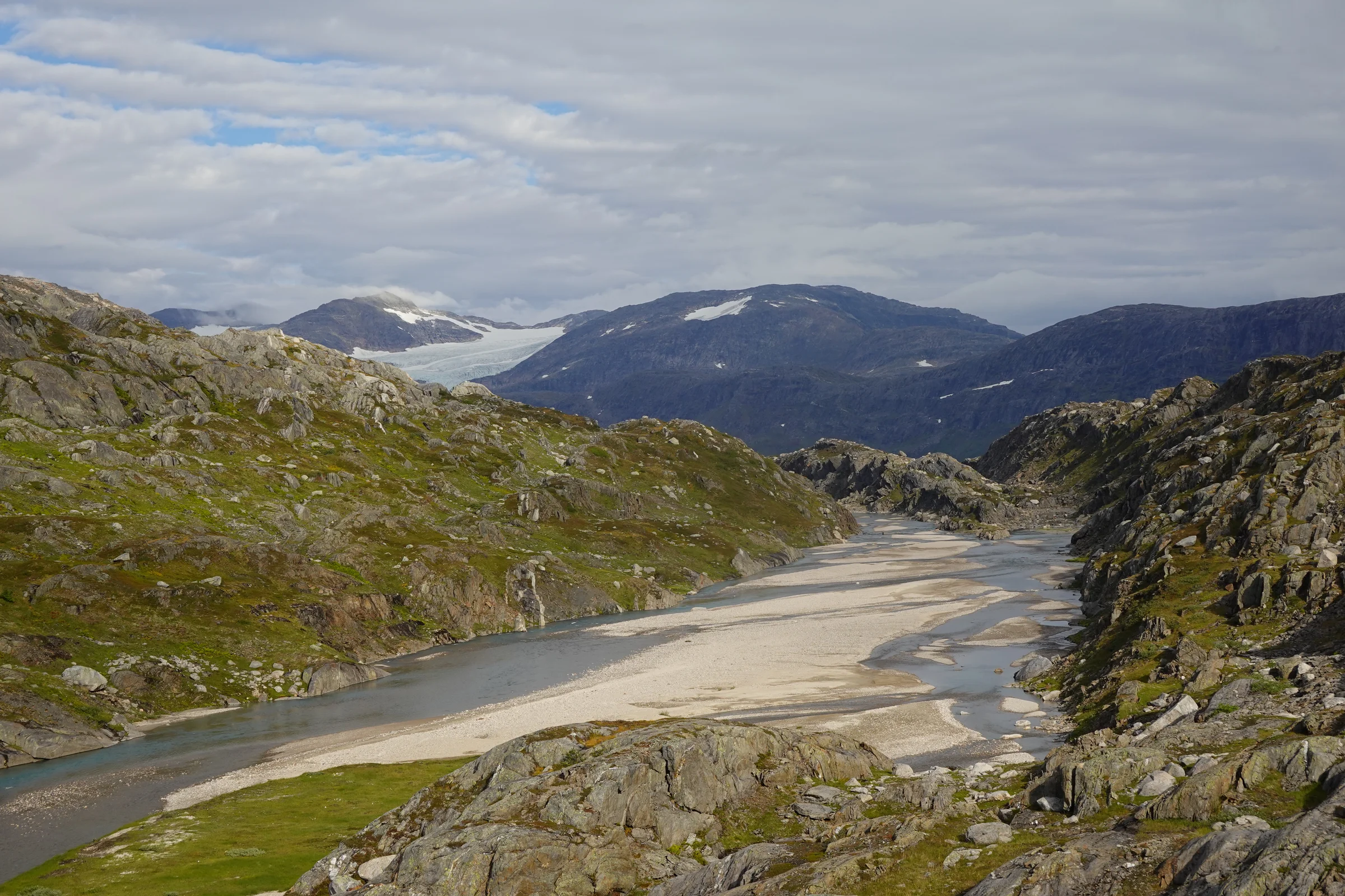
That evening, after several more kilometres of tough hiking, I pitched my tent at the edge of the fjord, looking across at glacier meltwater cascading a thousand metres into the sea. On the way back to the hut the next day I avoided the glacier, which let me see a different set of landscapes.
The canyon
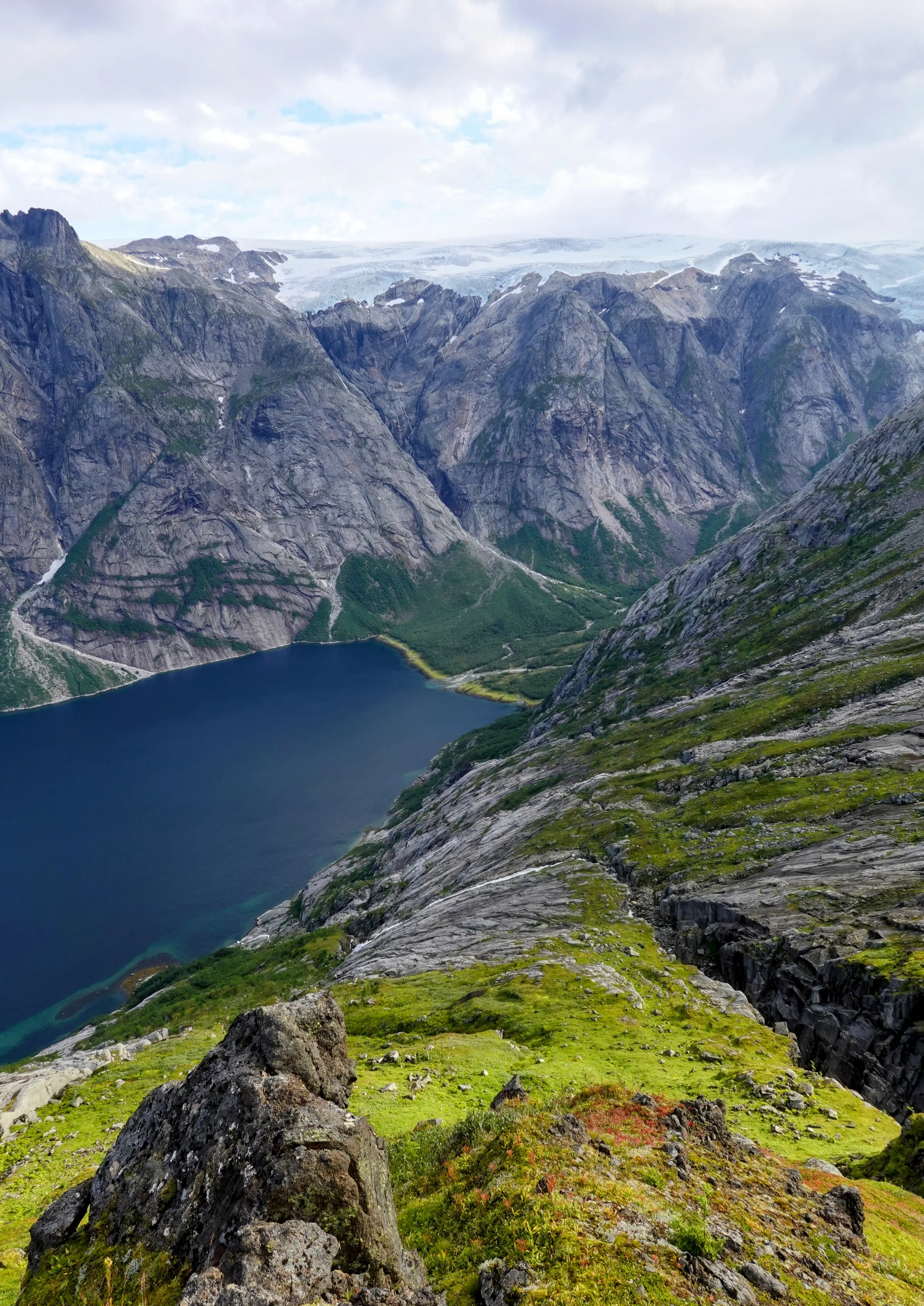
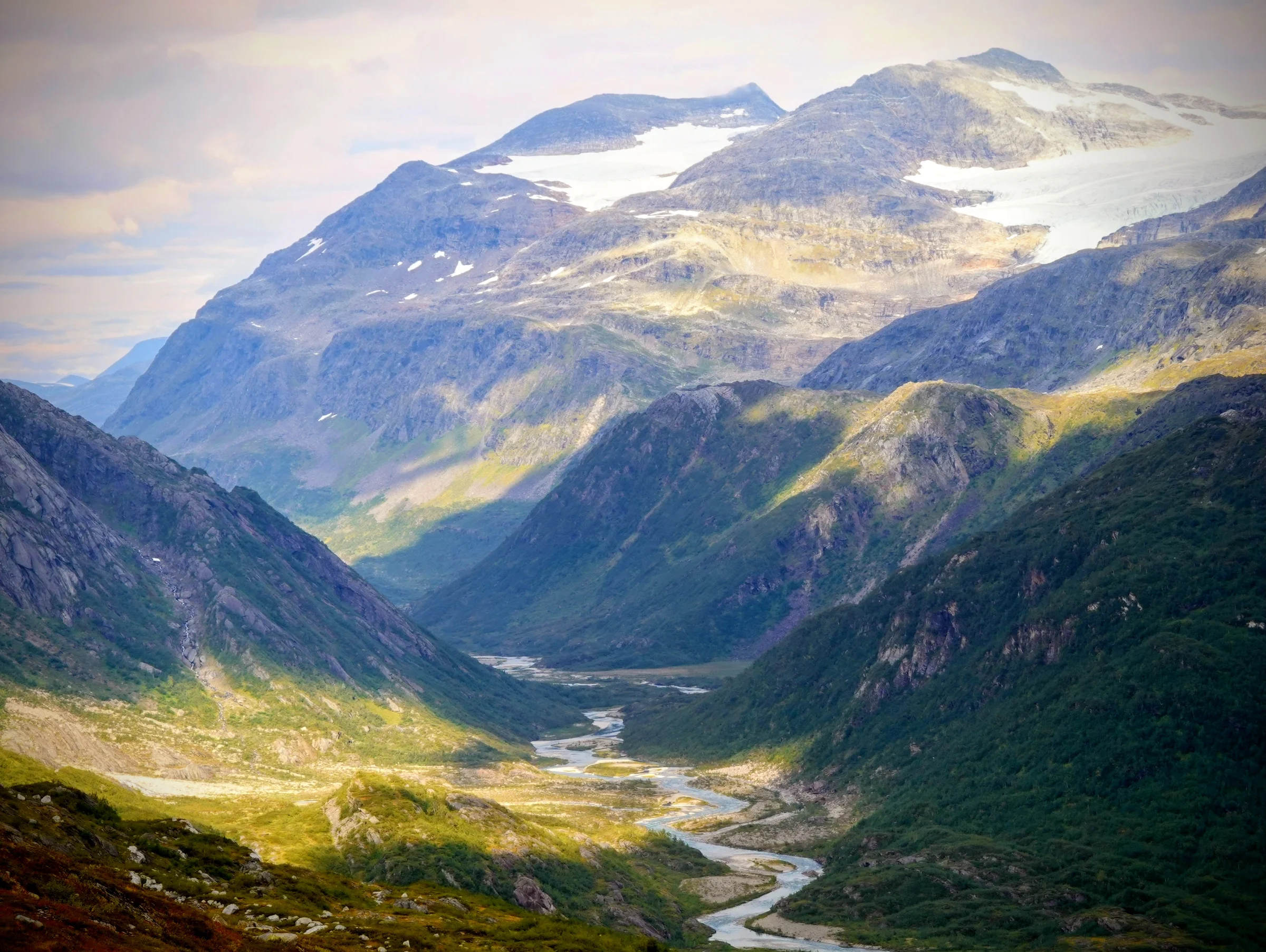
I left the hut with one day of good weather remaining. Near Glomdalsvatnet, which is accessible as a day hike from another park entrance, I briefly crossed paths with a family out for a lake visit. They were the first people I had met since the taxi driver at the start. But between Glomdalsvatnet and Austerdalsvatnet, the path vanished again and the terrain proved the toughest of the entire trip. The two sides of the valley are scored by rock bands about two metres high. The day was interminable: repeatedly entering and exiting the canyon at the valley bottom, scrambling, wading through mud, scratching my hands on the sharp rocks.
When Austerdalsvatnet finally came into view, I shed a tear. I’m not sure whether it was the beauty of the place or the relief of having passed the last real difficulty. Probably both.
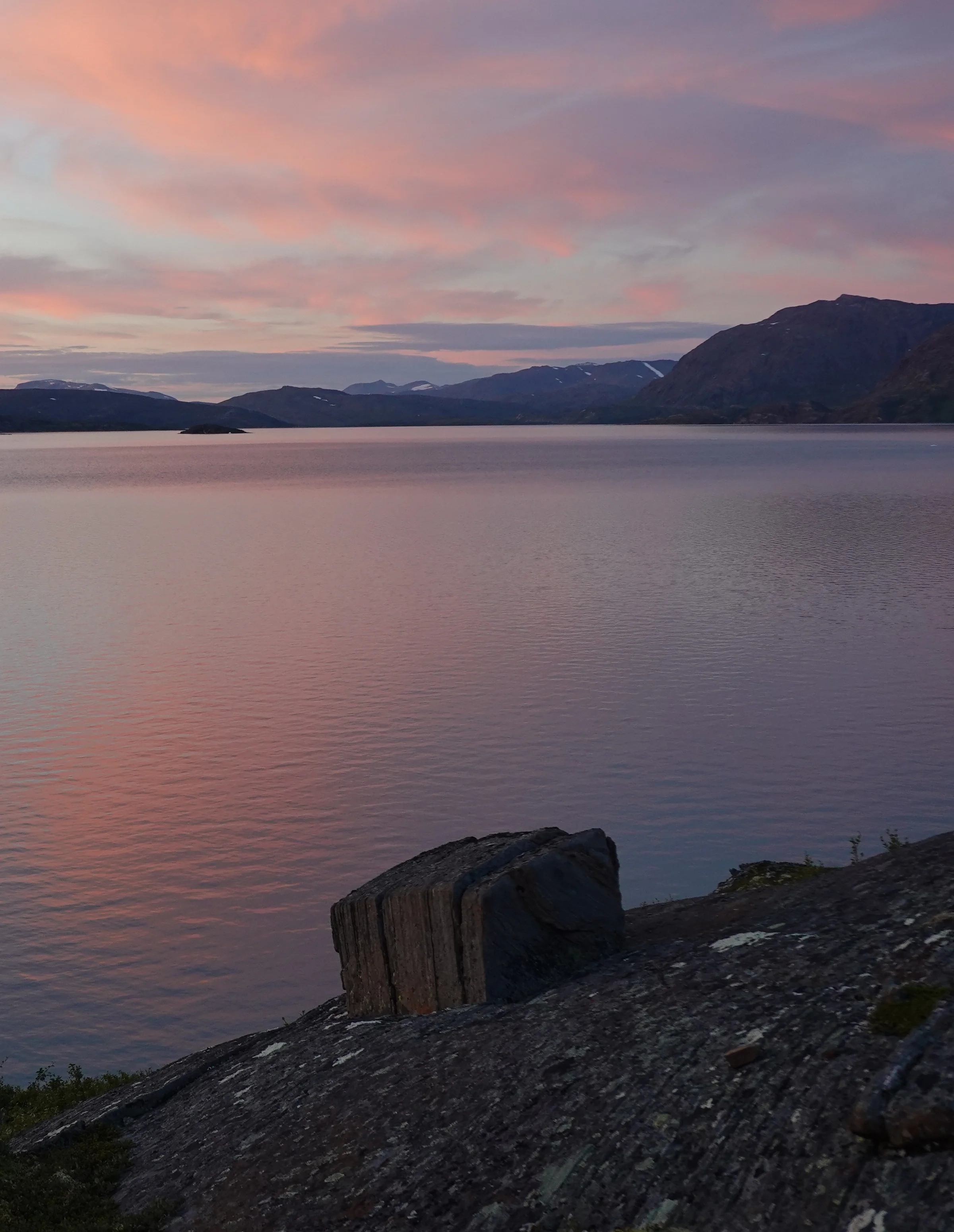
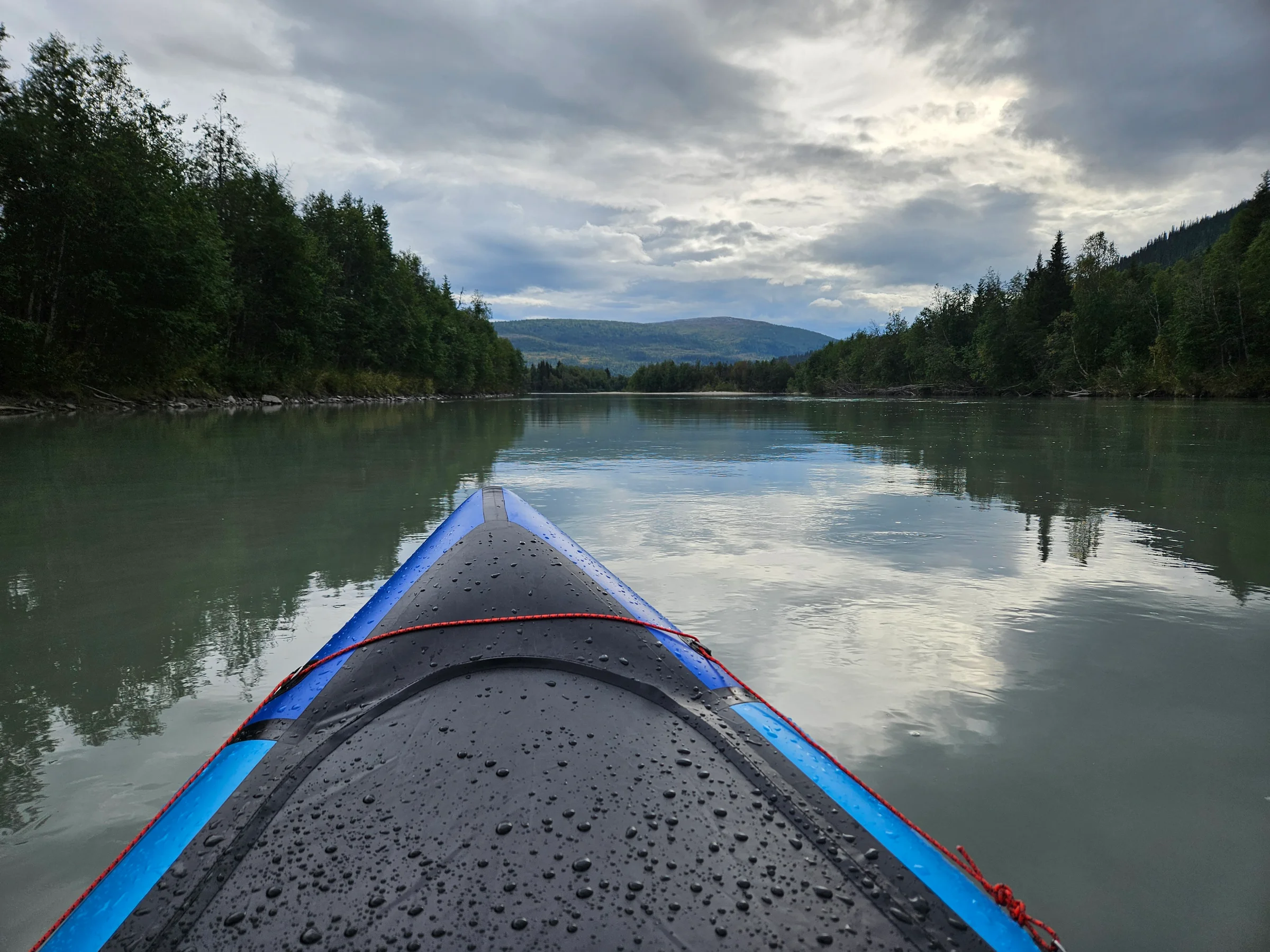
Out
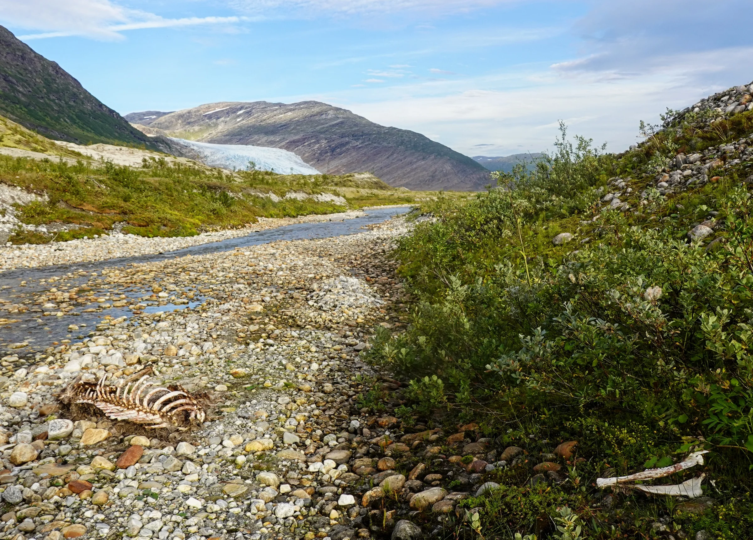
The weather had broken. All that remained was two small lakes and the peaceful Svartisåga carrying me toward Langvatnet. After the isolation of the previous days, the road running alongside the river gave me the feeling of a motorway. Between that and the driving rain, it was something of a mood killer. On the water, though, two golden eagles were feeding on a moose carcass on the bank. A few minutes later, a live moose crossed the river directly in front of me, making enormous splashes.
I arrived in Mo i Rana on the seventh day.
Getting there: I flew Amsterdam to Oslo. I didn’t quite have the courage to take the full train route via Germany and the Denmark ferry. Within Norway I took trains and buses, which limits the climate impact by roughly half.
This trip was published as a feature in Ardennes & Alpes, the magazine of the Belgian Alpine Club (issue 227).